
Web Desk: Forecasters warn that a potentially powerful El Niño could develop this summer and push global temperatures toward extreme levels.
Last week, the Climate Prediction Center of the U.S. National Oceanic and Atmospheric Administration said there is a 62% chance that El Niño will emerge between June and August. In simple terms, the climate pattern is now more likely than not this year.
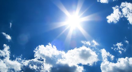
El Niño represents the warm phase of the El Niño–Southern Oscillation, or ENSO. This natural climate pattern involves changes in atmospheric conditions and sea surface temperatures across the tropical Pacific Ocean.
During El Niño, unusually warm waters gather in the eastern equatorial Pacific. This shift forces the jet stream southward. As a result, the northern United States usually experiences warmer and drier conditions. Meanwhile, the Gulf Coast and the southeastern United States face a higher risk of heavy rain and flooding.
At present, the Pacific Ocean remains in La Niña, the cold phase of ENSO. During La Niña, sea surface temperatures fall at least 0.9 degrees Fahrenheit, or 0.5 degrees Celsius, below the long-term average.
However, forecasters expect La Niña to weaken in the coming weeks as ocean temperatures begin to rise. El Niño conditions will develop if sea surface temperatures reach at least 0.9 F above the long-term average and remain there.
If the warming strengthens further, the event could become a “super El Niño,” according to AccuWeather. Scientists classify a super El Niño when sea surface temperatures reach at least 3.6 F, or 2 C, above average.
Paul Pastelok, a meteorologist and lead U.S. long-range forecaster at AccuWeather, said the event’s strength remains uncertain. However, he noted that forecasts suggest a moderate to possibly strong El Niño could develop from fall into winter.
AccuWeather estimates a 15% chance that a super El Niño could form by the end of the hurricane season in November. Meanwhile, NOAA’s Climate Prediction Center gives a one-in-three chance of a strong El Niño emerging between October and December. Officials say the potential strength remains highly uncertain.
El Niño can also influence hurricane activity. It usually increases storms in the central and eastern Pacific. At the same time, it suppresses hurricanes in the Atlantic. This pattern often leads to a quieter Atlantic hurricane season overall.
The ENSO cycle typically shifts between El Niño and La Niña every two to seven years. However, the timing is not always exact. Each phase generally lasts between nine and twelve months, though durations can vary.
The most recent El Niño began in May 2023 and lasted until March 2024. Ocean temperatures briefly crossed the threshold for a super El Niño during that event. However, they did not stay above the level long enough to qualify. The last confirmed super El Niño occurred in 2015–2016.
Scientists say the previous El Niño helped drive record global heat in 2023 and 2024. In fact, 2024 is currently the warmest year on record.
Climate scientist Zeke Hausfather said a new El Niño could push temperatures higher again. However, he noted that 2026 is unlikely to surpass 2024 because the year began under La Niña conditions.
Instead, the strongest warming effect may appear later. Hausfather wrote on social media that the event could raise temperature estimates for 2026. He added that 2027 could become the warmest year on record because ENSO events often affect global temperatures with a delay.
Scientists stress that El Niño is only one factor shaping global climate. Human-driven climate change continues to warm the planet. As a result, global temperatures are expected to keep rising regardless of ENSO conditions.
Read more: Weather update across major cities